This unique project utilized medians and fully mountable mini roundabouts in an essential urban corridor to improve safety while minimizing right-of-way impacts for the City of Columbus.
HISTORY
In the 1970s, the SR 161 corridor was widened and improved to its current configuration. SR 161 is a rapidly developing area, so to safely handle its projected traffic, improvements included modern ideas in access management, including medians and service roads close to mainline SR 161. The service road intersections along the SR 161 corridor are only separated by 60-70 feet, far short of the 300’ separation recommended by the National Cooperative Highway Research Program. The pair of service road intersections, in addition to the SR 161 intersection, created three closely spaced intersections with 96 total vehicular conflict points. As this area continued to develop, it became obvious that increasing traffic and service road intersections too close to SR 161 created a safety concern. Because of these safety concerns, the City of Columbus selected DLZ to prepare a corridor study, the State Route 161 Corridor Study (PID 97169). This study helped produce six short-term improvements and four long-term alternatives.
ALTERNATIVES
The short-term alternatives included an education plan, an enforcement zone, minor signal modifications, and ‘do not block the box’ intersection signs. One other constructed, short-term alternative included placing a queue cutter traffic signal at the end of the service road. This traffic signal provided a red light at the intersection of the Service Road with Cleveland Avenue to allow traffic entering Cleveland Avenue to cut across four lanes of traffic stopped by this signal and safely enter the southbound left turn lane. The long-term alternatives for the study included maintaining two-way operation on service roads with medians and mini roundabouts, relocating the service road intersections further from SR 161, placing cul-de-sacs at the end of the Service Roads, placing mid-block right in/right out for access, and removing left turn lanes and installing mid-block r-cuts.
PREFERRED ALTERNATIVE
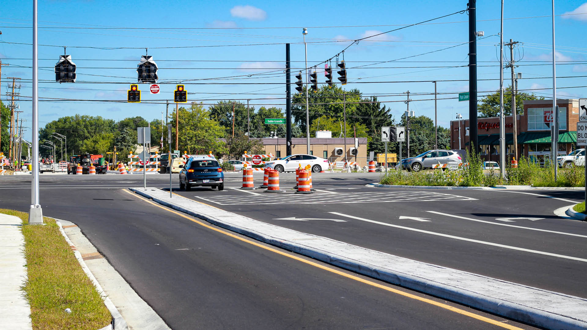
Based on the study’s results and feedback from stakeholders and the public, the preferred long-term alternative was to maintain 2-way operation on the service roads with medians on the side streets and mini-roundabouts to drastically decrease conflict points. Maple Canyon Avenue was selected to improve first because of its #3 ranking on the Mid-Ohio Regional Planning Commission’s (MORPC) yearly “Top 40 Regional High Crash Locations” list.
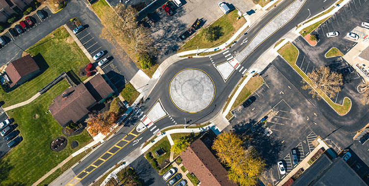
WHY USE MINI ROUNDABOUTS
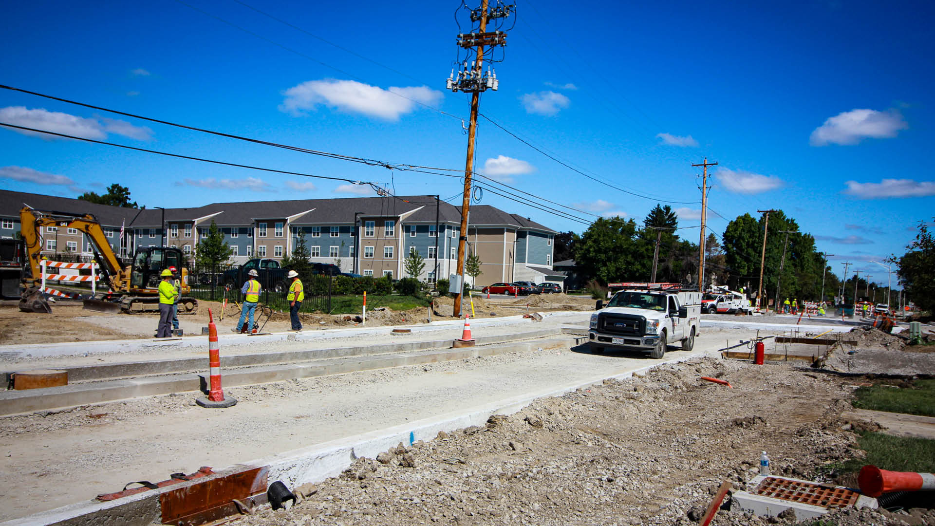
Using traditional roundabouts in this highly developed urban area would damage property significantly. With these being the first mini roundabouts designed in the City of Columbus, DLZ visited numerous mini roundabouts in Ohio and Michigan to observe their performance, evaluating many sizes of mini roundabouts, from 70’ ICD (Inscribed Circle Diameter) to 100’ ICD. Many design vehicles like passenger cars, semi-trucks, school buses, delivery trucks, and fire trucks were also evaluated, and to balance improved traffic operations with property impacts, Columbus selected a 90’ ICD. Columbus laid out this design in a parking lot and drove fire trucks and garbage trucks through the layout to ensure this mini-roundabout concept could accommodate the different vehicles. Medians were meticulously placed through the side streets to prevent through and left-turning movements. DLZ performed a queuing analysis to ensure traffic waiting at the SR 161 traffic signals would not back up into the mini roundabout. This location also includes the new Columbus Fire Station. A signal pre-emption for the SR 161 traffic signal was provided, as well as a depressed median with stamped concrete to allow emergency vehicles to turn left toward SR 161 across the median.
OTHER FEATURES
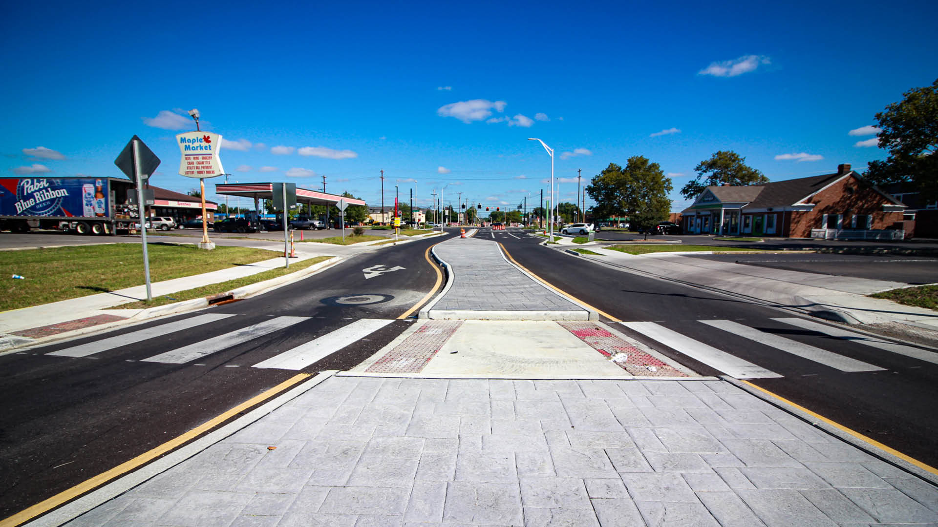
This project also included decorative, gray-stamped concrete, mainline SR 161 signal improvements, a shared-use path, storm sewer improvements, signal improvements, sidewalks, water improvements, street lighting, and BMPs including Silva Cells, oversized pipes, and bioretention swales.
COLUMBUS’ OVERALL VISION
This mini roundabout solution will eventually be constructed at seven sets of intersections along the SR 161 corridor. Construction was completed on Maple Canyon Avenue in September 2023, and this project has improved the corridor’s safety and traffic operations. Construction is underway or completed for three other mini roundabouts within the State Route 161 Corridor Study, and design is ongoing to place roundabouts at the remaining intersections.