


CCTV and NASSCO into GIS Geodatabase, Genesee County
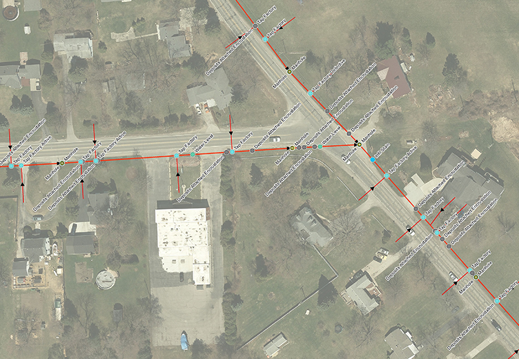
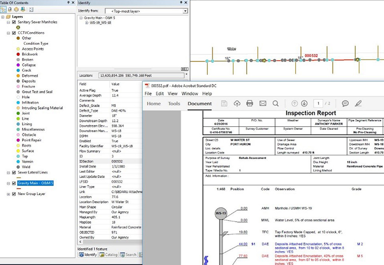
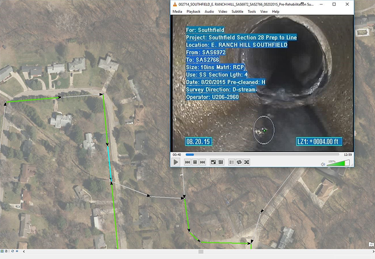
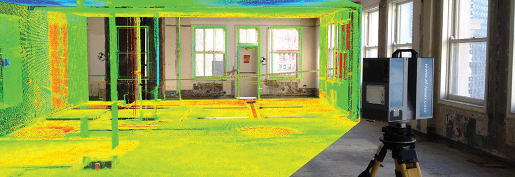
The Genesee County Drain Commissioner contracted DLZ for a project to integrate CCTV and NASSCO into a GIS Geodatabase. It involved integrating over 2,000 CCTV inspection and pipeline scoring projects into their ESRI geodatabase. This enabled quick retrieval and analysis using our data incorporation and query tool. DLZ developed a powerful and cost-effective application using ESRI’s ModelBuilder tool, which is a part of ArcMap, resulting in no additional software costs. The application facilitates the incorporation of CCTV inspection records and videos from PACP and NASSCO scoring databases. The estimated and actual rehabilitation cost information for a pipe can also be directly incorporated into the ESRI GIS geodatabase.
The application also includes basic navigation tools for easy viewing and analysis in the GIS geodatabase. In addition, it includes the capability to snap sewer leads to their PACP inspection data coordinates.
How did our solution leverage their investment in the ESRI geodatabase?
- By providing a cost-effective viewing and analysis capability
- Utilizing existing ESRI licenses without having to buy additional software licenses
- Saving additional development costs.
Apart from GIS capabilities, DLZ also provides other water services which include the design of wastewater and drinking water infrastructure.